We instinctively know that a walk in the garden or somewhere else filled with natural beauty is good for us but it is difficult to justify expensive or restrictive planning decisions on the basis of instinct alone. This is why scientists have been trying for years to quantify just how exposure to green space improves our mental and physical health. They have managed to show that what we see out of the window or walk past on the street really does matters for our stress levels and it is particularly good if what we see is plants. But how do we extend these results beyond small studies based on a few volunteers?
 As I’ve posted before there is an emerging field (Biophilomatics) which is using big data resources to look at these problems. This latest study from RBGE takes a new approach to the subject by plugging together some of the latest Google technologies in a novel way.
Computers are getting better at assessing the contents of our photos. If you use photo sharing sites you may have noticed that they use this technology to sort your photos by subject. Google has now given developers access to the algorithms behind their image classification systems through the Google Vision API. By combining this image recognition technology with Google Street View images from around Edinburgh we have demonstrated the possibility of assessing our cities streets for their perceived naturalness and potential restorative value using automatically sampled images.
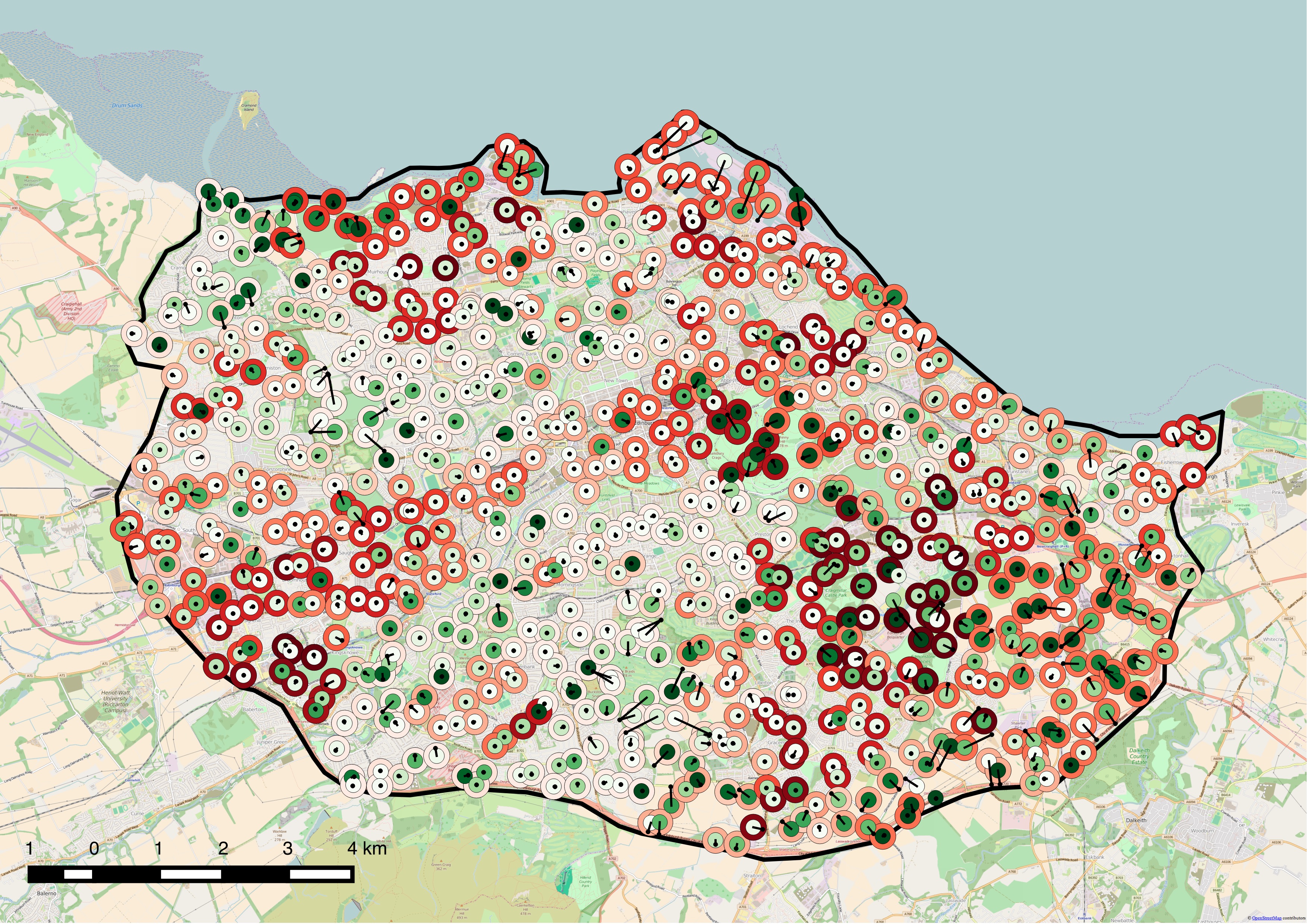
Map of Edinburgh showing sample area and points. Greener dots are more natural. Redder halos are more deprived according to the Scottish Index of Multiple Deprivation. Where Street View panoramas are offset they are joined to sample points by lines.
It is very early days yet and before we can draw strong conclusions we need to develop it further but this could be an addition to the tool box for building more liveable cities.
The work was done as part of the Edinburgh Living Landscape (ELL) project which involves a number of partner organisations with interest and skill in our shared environment. ELL promotes improving, expanding and connecting up the green space in the city and encourages innovation in greening up built structures recognising that the local natural environment is a health asset. There are key questions about how best to achieve this for all sectors of the population and the methodology described in this paper contributes to building the evidence base for decision making.
Below is a slide show of the randomly sampled Street View images. Is this the Edinburgh you know?
Note: There are privacy and other issues around street view images and Google therefore remove any areas they are requested to. In the slide show above images are loaded directly from Google and so any that have been removed or replaced since the experiment was originally carried out in early 2016 will appear as unavailable.